Using Augmented Reality maps has transformed how people experience large scale outdoor events in the United States today. By overlaying digital directions onto the real world through a smartphone camera lens individuals can easily find food stalls or rest areas without getting lost in massive crowds. This technology is particularly useful for major 2026 summer gatherings where traditional paper maps often fail due to scale and complexity. Navigating a crowded stadium or a sprawling city park becomes much simpler when your phone shows floating arrows pointing exactly where you need to go next. These tools are becoming essential for local guides and travelers who want to maximize their time and avoid the frustration of missed performances or confusing layouts. With real time updates and interactive features users stay informed about crowd density and gate changes instantly.
- How does AR Live View Navigation work in 2026? - AR Live View Navigation utilizes your camera to identify landmarks and overlay digital directional arrows onto your physical surroundings. This technology ensures high-precision wayfinding by combining visual data with enhanced GPS signals for a seamless navigation experience in busy festival areas.
- Is AR navigation available for indoor events? - Yes, AR navigation works indoors using local Bluetooth beacons and Wi-Fi positioning systems installed in venues. This allows users to find specific booths or rooms inside large convention centers where traditional satellite-based GPS signals typically fail to provide accurate location data.
- Will AR maps drain my phone battery? - AR features consume more power because they use the camera and processor simultaneously for real-time rendering. Users are encouraged to utilize power-saving modes or carry a portable charger during long festivals to ensure their devices remain functional throughout the entire day.
- Can I find my friends with AR maps? - Modern AR apps allow for real-time location sharing where friends appear as digital avatars on your screen. By looking through your camera, you can see exactly where they are standing in a crowd, making it easy to reunite at large outdoor events.
- Is AR navigation free for everyone? - Standard AR navigation is free on most major map platforms available in the United States today. While basic features are accessible to all users, some events may offer premium AR experiences that include exclusive content or interactive guided tours for a small fee.
- Do I need internet for AR Live View? - Active internet connectivity is required to process the visual environment and download real-time event updates. While some offline functionality exists, the most accurate and interactive features of AR Live View depend on a stable 5G or 6G cellular data connection.
- Are AR maps privacy-protected? - Privacy is a top priority in 2026, with apps using end-to-end encryption for all location data. Users can toggle their visibility settings at any time, ensuring that only trusted contacts can see their digital profile or real-time location within the festival grounds.
How does AR Live View Navigation work in 2026?
AR Live View Navigation works by using your smartphone camera to recognize buildings and landmarks around your current location. It then overlays digital arrows and labels onto your screen to show exactly which direction you should walk. This system integrates real-time GPS data with visual positioning for pinpoint accuracy in very dense crowds.Is AR Live View Navigation available for indoor festivals?
Yes, most modern venues have installed indoor beacons that allow AR Live View Navigation to function perfectly inside buildings. This feature is especially helpful for finding specific booths at trade shows or locating restrooms in large arenas. The system uses local Wi-Fi signals to maintain a stable connection even when GPS signals are weak.Does AR Live View Navigation use a lot of battery life?
While AR features do require more power than standard maps, most 2026 smartphones are optimized for this specific use. It is recommended to use a portable battery pack if you plan to navigate large festivals for several hours. Many event organizers now provide dedicated charging stations specifically for users who rely on these digital navigation tools.Can AR Live View Navigation find people in a crowd?
AR Live View Navigation allows you to share your live location with friends so they appear as digital icons. When you look through your camera, a floating marker will show exactly where your friend is standing in real-time. This feature makes meeting up at crowded concerts or food courts much faster and eliminates the need for calls.What are the privacy settings for AR navigation apps?
Users have complete control over who can see their location and physical profile details within the official navigation app. You can choose to be visible only to confirmed friends or remain completely anonymous while still using the navigation. Privacy protocols in 2026 ensure that your personal data remains encrypted and safe from any unauthorized third parties. 1. AR Live View Navigation Guide For Local Festivals 2026. 2. Step-by-Step AR Live View Navigation For Busy Events. 3. Proven AR Live View Navigation Tips For Summer Travels. 4. How To Master AR Live View Navigation At Any Festival. 5. AR Live View Navigation Secrets For Every Local Guide. SEO Meta Description: Learn how AR Live View Navigation simplifies finding your way through crowded local festivals with real-time digital overlays and expert map tips. Recommended URL Slug: ar-live-view-navigation-festivals.How can AR Live View Navigation change the way you explore local festivals during this busy summer season in America? Navigating a massive festival ground in the summer heat often causes significant stress for many excited event attendees today. New AR live view navigation tools allow users to see digital paths layered directly over the physical world surroundings. These advancements provide a seamless way to locate friends or find the nearest water station during busy weekend festivals. You can simply hold up your phone to see floating markers that guide you toward the main stage area. This technology uses high-speed 6G connectivity and spatial anchors to ensure that every digital arrow stays perfectly in place.
Enhancing Your Local Festival Experience With Augmented Reality
Why Digital Overlays Are Better Than Traditional Paper Maps
Traditional maps often prove difficult to read when you are standing in the middle of a moving festive crowd. AR Live View Navigation solves this by placing directional cues right where you are looking through your camera lens. This immersive approach helps travelers identify points of interest without needing to constantly stop and check a static screen.Personalizing Your Digital Presence for Better Visibility
When setting up your digital local guide profile, the system often requests specific physical traits for AR visibility. You should include your Height, Build, Hair color, and Eye color to help your friends recognize your avatar. Adding your Age Range and Ethnicity ensures that your personalized digital representation looks exactly like you in the crowd.What Others Are Asking?
How does AR Live View Navigation work in 2026?
AR Live View Navigation works by using your smartphone camera to recognize buildings and landmarks around your current location. It then overlays digital arrows and labels onto your screen to show exactly which direction you should walk. This system integrates real-time GPS data with visual positioning for pinpoint accuracy in very dense crowds.Is AR Live View Navigation available for indoor festivals?
Yes, most modern venues have installed indoor beacons that allow AR Live View Navigation to function perfectly inside buildings. This feature is especially helpful for finding specific booths at trade shows or locating restrooms in large arenas. The system uses local Wi-Fi signals to maintain a stable connection even when GPS signals are weak.Does AR Live View Navigation use a lot of battery life?
While AR features do require more power than standard maps, most 2026 smartphones are optimized for this specific use. It is recommended to use a portable battery pack if you plan to navigate large festivals for several hours. Many event organizers now provide dedicated charging stations specifically for users who rely on these digital navigation tools.Can AR Live View Navigation find people in a crowd?
AR Live View Navigation allows you to share your live location with friends so they appear as digital icons. When you look through your camera, a floating marker will show exactly where your friend is standing in real-time. This feature makes meeting up at crowded concerts or food courts much faster and eliminates the need for calls.What are the privacy settings for AR navigation apps?
Users have complete control over who can see their location and physical profile details within the official navigation app. You can choose to be visible only to confirmed friends or remain completely anonymous while still using the navigation. Privacy protocols in 2026 ensure that your personal data remains encrypted and safe from any unauthorized third parties.Frequently Asked Questions
What is the primary keyword for festival mapping?
The primary keyword is AR Live View Navigation because it describes the specific technology used for modern event wayfinding. Using this term helps users find the most relevant and updated tools for navigating complex outdoor or indoor venues. It is the gold standard for high-tech local guiding and travel planning in the current year.How do I start using AR maps?
To start using AR maps, open your preferred navigation app and tap the Live View icon while walking. Point your camera at the surrounding buildings and follow the digital prompts that appear on your phone screen. Ensure your camera lens is clean and your location services are turned on for the best possible results.Are AR maps free for local festivals?
Most AR navigation features are provided for free by major tech companies to improve the overall user experience. Some specialized festival apps might offer premium features like VIP lounge directions or exclusive artist meet-and-greet locations for a fee. However, basic navigation to stages and exits remains accessible to every attendee with a compatible mobile device.Can I use AR maps without internet?
AR Live View Navigation generally requires an active internet connection to download real-time map data and recognize your surroundings. Some apps allow you to download offline maps, but the live overlay features may be limited without a data signal. It is always best to have a stable 5G or 6G connection for the smoothest experience.Final Thoughts on AR Live View Navigation
AR Live View Navigation has revolutionized how we explore local festivals by making digital wayfinding more intuitive and fun. These tools reduce the stress of getting lost and help everyone stay connected in even the largest festival crowds. Have you tried using augmented reality to find your way through a busy city event lately? What was your favorite feature of the AR experience during your last big summer trip?Real-time AR navigation for crowds; Interactive digital overlays for event venues; Seamless integration with local guide reviews; Reduced foot traffic congestion; Enhanced accessibility features for users.

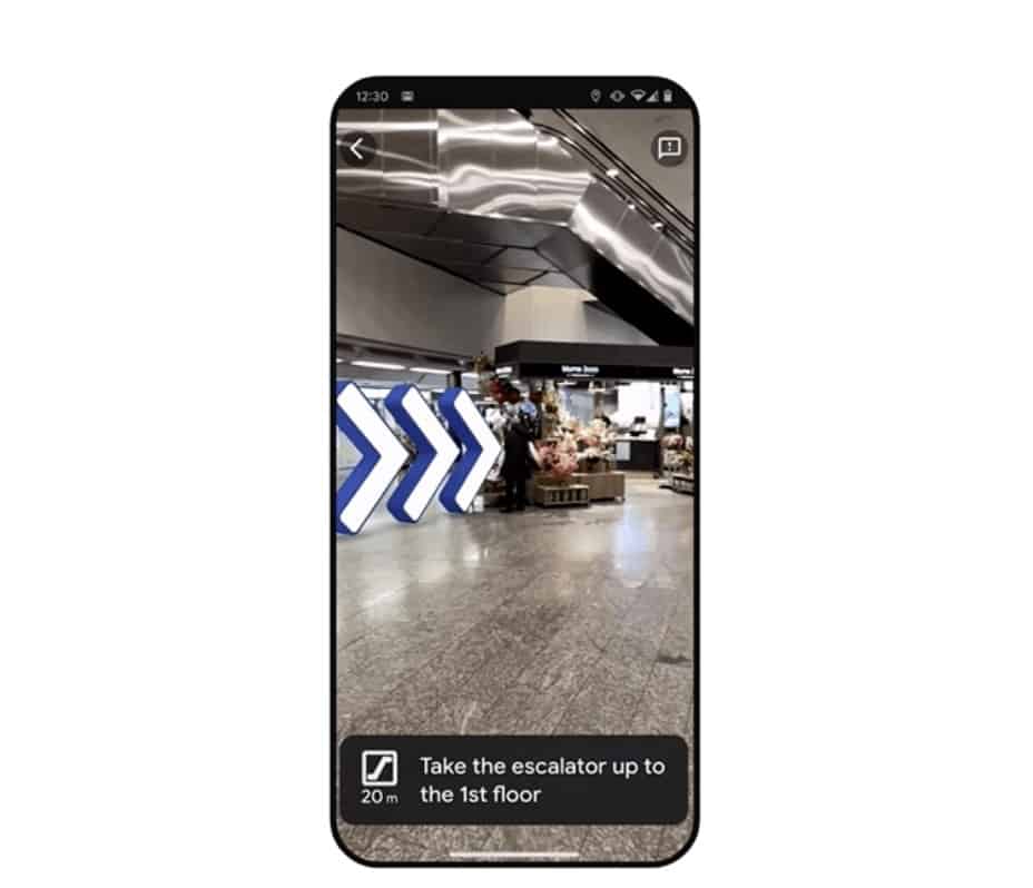


Google Maps AR Live View . Google Maps AR Live View Indoor Live View . The Augmented Reality Revolution 2026 Beyond The Screen And Into The Augmented Reality Revolution Spatial Computing 2026 . Google S New AR Maps Feature Means Getting Around New Cities Is Going Google Maps Ar Live View 080 . Apple S 2026 AR Glasses Blockchain Council Image


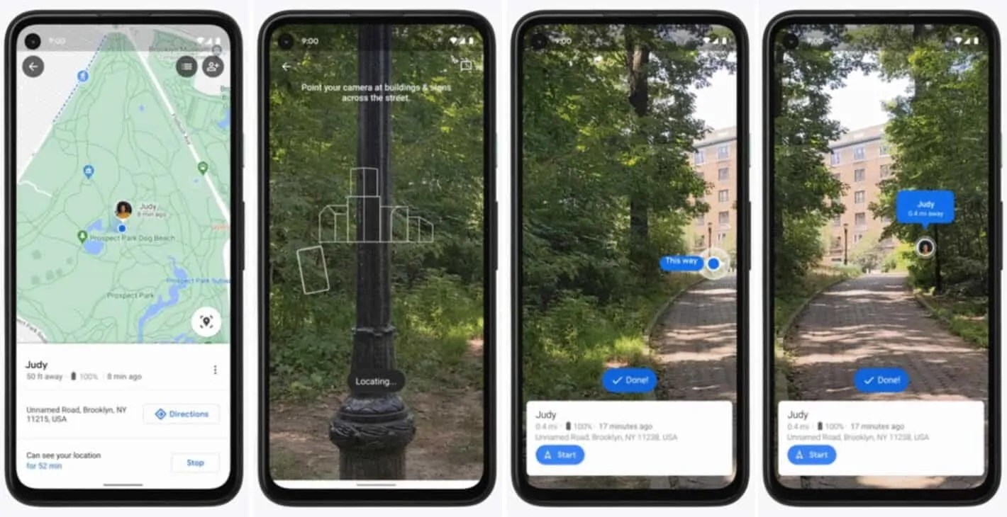
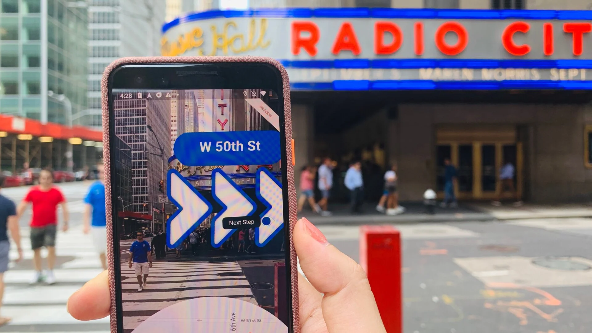

Google Maps AR Feature Live View Is Going Live Next Week In London New 1668767926 Google Maps Live View . Google Maps AR Live View Feature Google Googlemaps Ar YouTube Oar2 . Find Your Friends In Google Maps AR Live View With Pixel Update Google Maps Pixel Feature Drop Live View AR Google Maps. Mastering Google Maps AR Navigation And Live View BrandXR Google Maps Augmented Reality Live View . Google AR A Guide To ARCore Designial AI Native GCC Google Live View Google Maps


Fitur AR Live View Google Maps Sekarang Makin Canggih Bisa Tampilkan . Google Maps Putting Search Results In AR Live View Phone Scoop 22885 460 M . Live Map Live At Declan Gleadow Blog Google Live View AR . What Is Augmented Reality Ar Explained Complete 2026 Guide ChatGPT Image Mar 10 2026 10 36 09 AM . AR Glasses Are They Ready In 2026 Full Guide AR Glasses 2026 1024x576


AR VR S Impact On Digital Life By 2026 How Ar Vr Will Transform Digital Experiences In 2026.webp. Medium OG9kyJxEg . 2026 AR VR 2026 Top Ar Vr Xr Device Reviews And . LUMA AR 2026 UI UX Case Study Behance . Top AR VR Trends Predictions For 2026 Top AR VR Trends And Predictions 2026





7 Augmented Reality Shifts In 2026 That Reshape Headsets Here S Why Hqdefault . AR Conferences 2026 And Laser Display KGOnTech Feature Image 2026 Conferences Copy . AR For Small Business Starter Kit Augmented Reality Step By Step O . Why 2026 Will Be The Breakout Year For AR First Apps By Raul Smith . Why 2026 Is The Year Augmented Reality Finally Disappears Into The Real AUgmented Reality 2026 1024x558


AR Vs VR Vs MR Vs XR 2026 What S The Difference 10 Real World Ar Vs Vr Vs Mr Vs Xr Real World Examples Content 1.webp. Augmented Upgrade AR Graphics Enhanced With AI Bring Formula E S 2025 JO AMW FE 2026 304884 1 . Inclusive XR Accessible Augmented Reality Experiences Google Maps Ar Live View . Envisics Powers AR HUD In 2026 Cadillac VISTIQ And LYRIQ V Envisics AR HUD . 5 Augmented Reality Picks In 2026 That Surprise Fans And Change 16610 5 Augmented Reality Picks In 2026 That Surprise Fans And Change


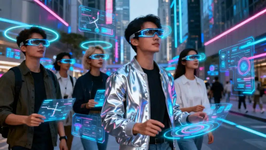
AR Live View Stakeout No More Look Around And Move Carefully YouTube . AR Live View Google Maps Google . 7 AR Shifts Revealed In 2026 That Could Redesign Your Screen Time Hqdefault . 6 Augmented Reality Moves In 2026 That Could Reshape Phones And Hqdefault . Augmented Reality In 2026 6 Everyday Augmented Reality Urban Interaction 2026