Dive into the crucial era of America before the Civil War with detailed historical maps. Understand the complex territorial expansions, the contentious spread of slavery, and the evolving political boundaries that shaped a nation on the brink of conflict. This navigational guide explores key geographical divisions like free vs slave states, the impact of the Missouri Compromise, and the Compromise of 1850. Discover interactive Local MAP resources and high-definition Maps that illuminate the socio-economic landscapes and infrastructure of the 1840s and 1850s. Perfect for students and history enthusiasts alike, this resource provides a clear visual understanding of the forces that ultimately led to secession and war. Learn where to find the most accurate and engaging visual representations of this pivotal period, enhancing your grasp of American history. Explore these critical maps to truly visualize the tensions and transformations of a divided nation.
- What defines the Map of America before the Civil War? - It shows a nation expanding westward but deeply divided by slavery. Maps highlight free states, slave states, and territories, revealing the geographical tensions and political compromises like the Missouri Compromise that characterized the antebellum period before the Civil War.
- Where can I find interactive Local MAPs of the US in the 1850s? - Interactive Local MAPs for the 1850s are primarily available through digital historical archives. Resources like the Library of Congress, David Rumsey Map Collection, and university special collections offer zoomable, high-resolution images, often with overlays for data like population or production.
- How did the Compromise of 1850 affect the Map of America? - The Compromise of 1850 temporarily altered the map by admitting California as a free state, establishing territorial governments for New Mexico and Utah with popular sovereignty, and strengthening the Fugitive Slave Act. It intensified debates over slavery's expansion, visibly changing state and territorial boundaries.
- What do historical Maps reveal about slavery's presence before the Civil War? - Historical Maps clearly delineate slave states, often showing the distribution and density of enslaved populations. They visualize the economic geography, such as cotton belts, demonstrating slavery's profound impact on the Southern states' boundaries and agricultural landscape.
- What were the main territorial disputes visible on pre-Civil War US Maps? - Key territorial disputes included the status of Western territories acquired from Mexico, particularly regarding whether they would become free or slave states. The Kansas-Nebraska Act created severe conflict, turning Kansas into a focal point of violent struggle, visible on period maps.
- Can I trace westward expansion routes on Maps of antebellum America? - Yes, many antebellum Maps illustrate key westward expansion routes like the Oregon Trail, Santa Fe Trail, and California Trail. These Maps show the paths settlers took and how new territories were progressively integrated, expanding the nation's visible footprint.
- Why are historical Maps crucial for understanding the causes of the Civil War? - Historical Maps provide an indispensable visual context for the Civil War's origins. They show the deepening geographical divisions, the impact of federal policies on territories, and the fundamental sectional differences in economy and culture that ultimately led to war.
- What does the Map of America before the Civil War primarily show?It visually depicts the growing sectionalism, highlighting the division between free states, slave states, and territories. Key maps illustrate territorial expansion and the political compromises designed to manage slavery's spread.
- Where can I view high-definition images of pre-Civil War US Maps?HD images are readily available on platforms like the Library of Congress, David Rumsey Map Collection, and university digital archives. Many historical societies also host online collections for public access.
- How did territorial expansion change the Map of America leading to the Civil War?Expansion westward intensified debates over slavery, with each new territory requiring decisions on its status. This constantly redrew the map, creating flashpoints like Kansas and Nebraska, directly influencing the conflict.
- Are there interactive Maps showing the Missouri Compromise and Compromise of 1850?Yes, numerous interactive maps visualize these crucial compromises. They show the lines drawn and the states or territories affected, helping understand their temporary resolution of the slavery issue.
- What visual data can I find on an 1850s Map of America?Maps from the 1850s often include population density, agricultural production (especially cotton), railway lines, and the distribution of enslaved people. They reveal the socio-economic factors driving sectional tensions.
- How can Local MAP features help understand pre-Civil War US geography?While not 'local' in a modern sense, digital Local MAP tools allow zooming into historical regions, comparing different periods, and overlaying various data points to analyze local impacts of national policies.
- What were the key geographical divisions on the Map before the Civil War?The primary divisions were the free states in the North, slave states in the South, and unorganized or disputed territories in the West. The Mason-Dixon Line and the 36°30' parallel were significant demarcation lines.
Ever wondered how America looked right before the storm of the Civil War? It was a time of immense growth, deep division, and shifting borders. Understanding this pivotal era starts with its maps. We're talking about the crucial visual records that show where free states ended and slave states began, the territories still up for grabs, and the pathways that defined a nation on the brink.
Frequently Asked Questions
Where can I find the best interactive maps of America before the Civil War?
The absolute best locations for interactive pre-Civil War maps are online digital archives like the Library of Congress Digital Collections and university libraries such as David Rumsey Map Collection. Also, National Archives provides excellent resources.
How do I navigate detailed Local MAPs of pre-Civil War America online?
Pull up your preferred digital Maps platform or historical archive website. Use zoom and layer functions to explore economic data, population density, or territorial disputes. Most are available 24/7, offering instant access to historical data.
What are the best times or platforms to explore detailed online maps of the US before the Civil War?
Anytime is great for online exploration. For focused study, use platforms offering high-resolution downloads:
- Library of Congress for primary source clarity.
- David Rumsey Map Collection for diverse themes.
Here's a quick guide to key online map resources:
- Resource: Library of Congress Digital Collections / Focus: 1840-1860 Territorial Expansion, Slavery Divisions
- Resource: David Rumsey Map Collection / Focus: Sectionalism, Compromises, Economic Data
- Resource: National Archives / Focus: Border Disputes, Political Boundaries
Visualizing territorial expansion and sectionalism. Understanding free and slave states dynamics. Impact of key compromises on the map. Mapping economic and demographic shifts. Navigating digital archives for historical maps. Pre-Civil War America's geographical divides.


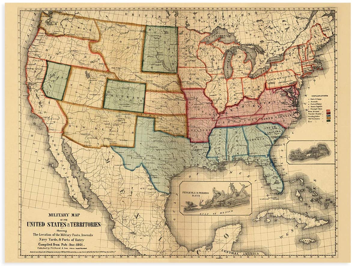

Map Of USA Before The Civil War Printable US Maps Boundary Between The United States And The Confederacy Map Of Usa Before The Civil War . Map Of Us Before Civil War . Map Of USA Before The Civil War Printable US Maps Dateislave And Free States Before The American Civil War Svg Map Of Usa Before The Civil War . Map Of America Before The Civil War 21 7 . Us Map Before Civil War 18. Civil War Map 1 Final Edited 7


PPT Integrated Literacy Assignment PowerPoint Free Us Map Before The Civil War L . A Nation Divided The US Map Before The Civil War Screen Shot 2017 03 02 At 10 42 04 Pm Orig . A Nation Divided US Map Before Civil War United States Civil War Map 1860 1 Scaled . Civil War Territory States 20390 . Civil War Map Photos And Premium High Res Pictures Getty Images Map Of The United States Prior To The Civil War Tinted To Illustrate Areas Of Freedom And


America Divided Before Civil War Lessons To Be Learned 5aa6bdb7 Ce0c 48ec A88a . PreCivil War US A Nation Divided StatesMap . Before The Civil War Map Of America 1024x1024 . Map Of America Before The Civil War Page143 . Map Of USA Before The Civil War Places In American Civil War History Maps Depicting Prologue To Inside Map Of Usa Before The Civil War 768x480


PreCivil War US A Nation Divided Civil War Color . A Nation Divided The US Map Before The Civil War 7914064 Orig . Map Of USA Before The Civil War Printable US Maps Places In American Civil War History Maps Depicting Prologue To Map Of Usa Before The Civil War 150x150 . Civil War Map Of States 91686381 1268 47b0 8347 . American Civil War Uniforms A Visual Journey American Civil War Maps Battlefield Generals


American Civil War Map North And South US . Confederacy Us Civil War 21119 . 2 11 Civil War 388685527 . Map Of Us Before Civil War Map Areas Of American Civil War V0 . American Civil War DIEGCSE 789111327




15 Thousand Mapping Royalty Free Images Stock Photos Stock Vector American Civil War Map Vector Education 2600271227 . Us Map Before Civil War Map . American Civil War Wallpaper Border . Pre Columbian Tribes A 6000 Year Long Genomic Transect From The Pre Colonized America Indigenous Territories Map . America Before Unveiling Lost Maps

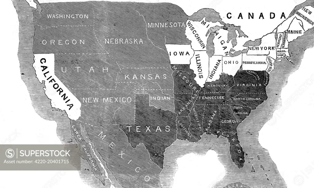


French And Indian War Map Before And After Z6bm6m Processed . During The Civil War Territory Map With States Territory War Hacked 4220. Pre Mexican American War Map . A Nation Divided US Map Before Civil War F3ea8c68 19a2 49b0 B0fc 723x463 . American Civil War Map CIVIL WAR